Property Information Report

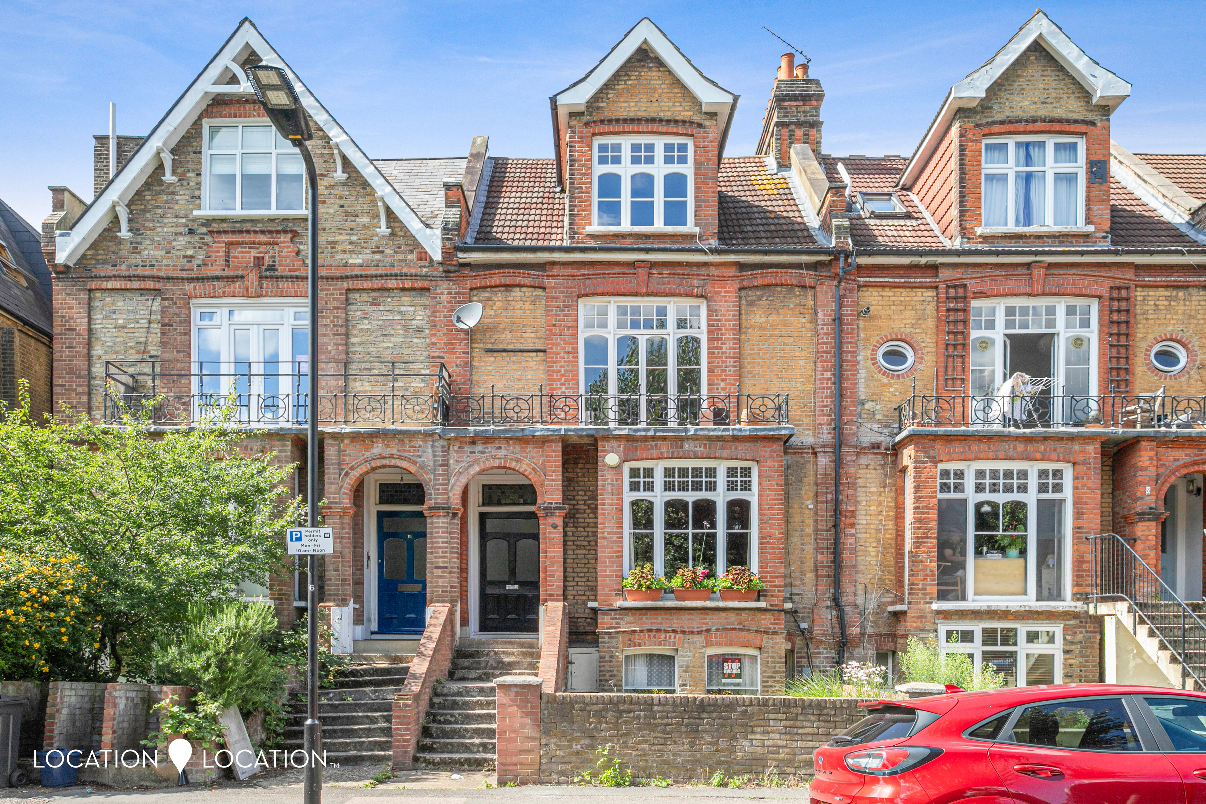
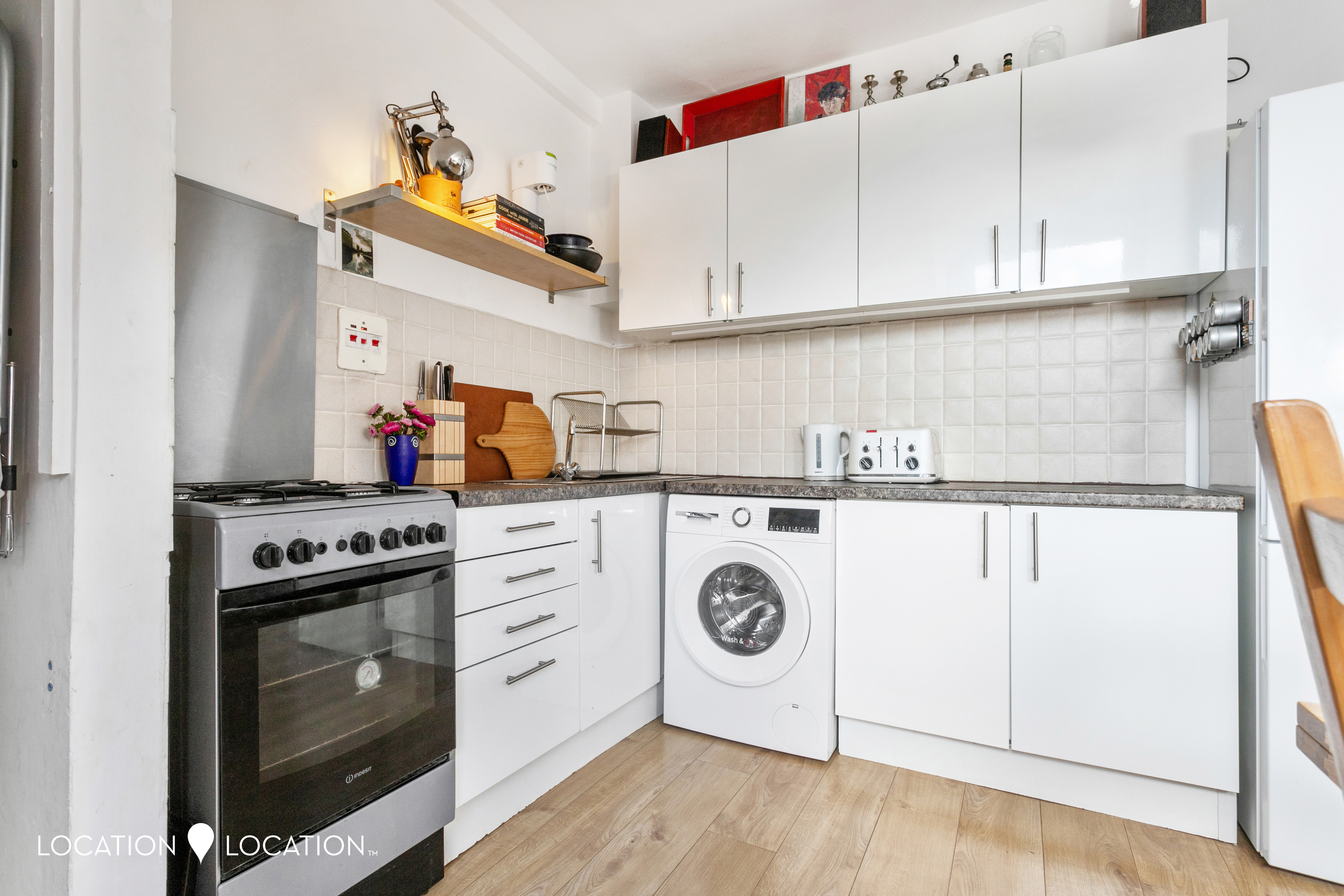
Flat 3, 9 West Bank
London, N16 5DG
Last Sold - Jan, 2024
Key Facts
No lease data available
About Us

About Us
Since 2006 we’ve committed ourselves to helping people move happy. We do so with a promise to support the local community too. We feel estate agency can and should be done differently; in a professional and yet personal way. Everything we do is designed around you and our team of property experts all have one thing in common – they care.
Find out more at locationlocation.com
Title Plan
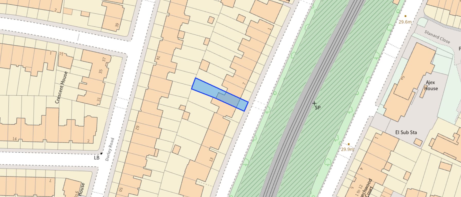 Contains OS data © Crown copyright 2025
Title Information
Details provided by the Land Registry
- Title Number
- LN55282
- Plot Size
- 0.05 acres (216 sq metres)
Generate a full report on your own property including an instant estimated valuation.
Street View
House Prices in Hackney
Last 12 months
-
Average Price Change
£14,785
Decreased by 2%
-
Flats/Maisonettes Price Change
£14,840
Decreased by 3%
Average House Prices
Last 12 months for all property types.
Since Last Sale - 12th January 2024
-
Average Price Change
£5,689
Decreased by 1%
-
Flats/Maisonettes Price Change
£11,284
Decreased by 2%
Average House Prices
Since 2020 for all property types
EPC
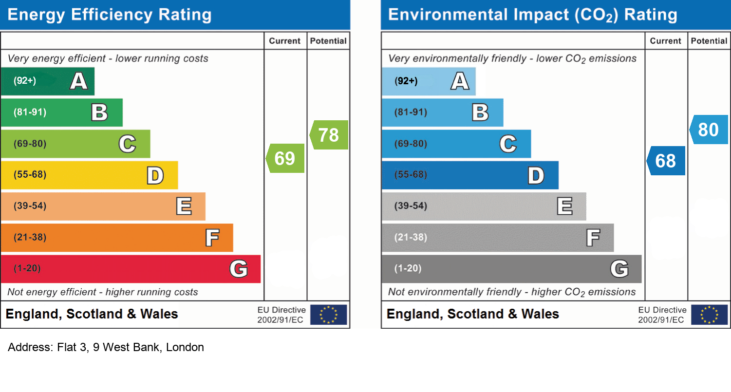
EPC Information
Details taken from the EPC register
- Date
- 2023-08-31
- Valid Until
- 2033-08-30
- Energy Efficiency - Current
- 70
- Energy Efficiency - Potential
- 77
- Environmental Impact - Current
- 69
- Environmental Impact - Potential
- 78
Recently Sold Properties in the Area
| Address | Property Type | Distance | Price | Completed |
|---|---|---|---|---|
|
62 Durley Road London, N16 5JS |
Terraced | 50 metres away | £1,237,500 | 3 months ago |
|
Flat 10, Beechwood Lodge, 5 East Bank London, N16 5RX |
Other | 94 metres away | £340,000 | 6 months ago |
|
Flat 5, Parklea Court, 86 Durley Road London, N16 5JT |
Flats/Maisonettes | 0.10 km away | £350,000 | 8 months ago |
|
18 Denver Road London, N16 5JH |
Flats/Maisonettes | 0.14 km away | £630,000 | 10 months ago |
|
12 Stanard Close London, N16 5EH |
Terraced | 0.15 km away | £710,000 | 8 months ago |
|
22b, Durley Road London, N16 5JS |
Flats/Maisonettes | 0.16 km away | £585,000 | 1 month ago |
|
54 Cranwich Road London, N16 5JN |
Terraced | 0.19 km away | £1,300,000 | 9 months ago |
|
Flat 11, Stroh Court, 9 Amhurst Park London, N16 5DH |
Flats/Maisonettes | 0.22 km away | £390,000 | 8 months ago |
|
23 Northfield Road London, N16 5RL |
Terraced | 0.24 km away | £1,420,000 | 10 months ago |
|
70 Cranwich Road London, N16 5JD |
Flats/Maisonettes | 0.26 km away | £630,000 | 11 months ago |
Schools
| Name | Type | Postcode | Distance | Rating |
|---|---|---|---|---|
| Beis Rochel d'Satmar Girls' School | Independent, Nursery, Primary, Post 16 | N16 5DL | 0.16 km | Not rated |
| Bnois Jerusalem Girls School | Independent, Nursery, Primary | N16 5DL | 0.16 km | Not rated |
| Vishnitz Girls School | Independent, Nursery, Primary | N16 5DL | 0.16 km | Inadequate |
| Beis Yaakov Girls School | Independent, Nursery, Primary | N16 5DH | 0.18 km | Good |
| All Saints Catholic High School | Secondary, Post 16 | N16 5AF | 0.22 km | Good |
Transport
Bus Stops & Stations
Details provided by Department for Transport
| Name | Distance |
|---|---|
| Stamford Hill Station, AMHURST PARK | 0.12 km |
| Amhurst Park / Stamford Lodge | 0.26 km |
| Cranwich Road | 0.35 km |
| Stamford Hill | 0.36 km |
| Stamford Hill Broadway, STAMFORD HILL | 0.37 km |
Train Stations
Details provided by Department for Transport
| Name | Distance |
|---|---|
| Stamford Hill Station | 0.14 km |
| Stamford Hill Rail Station | 0.15 km |
| South Tottenham Station | 0.86 km |
| South Tottenham Rail Station | 0.87 km |
| Seven Sisters Station | 0.97 km |
Nearest Motorway
Details provided by Department for Transport
| Name | Distance |
|---|---|
| M11 | 8.13 km |
Tram and Metro Stations
Details provided by Department for Transport
| Name | Distance |
|---|---|
| Seven Sisters Station | 0.95 km |
| Seven Sisters Underground Station | 1.16 km |
| Manor House Underground Station | 1.28 km |
| Manor House | 1.28 km |
Coverage
- Average Broadband Speed:
-
13mb Basic
-
70mb Superfast
-
70mb Overall
- Mobile Coverage:
-
EEOkay
-
O2Good
-
ThreeGood
-
VodafoneOkay

Location Location, 18 Stoke Newington Church Street, London, N16 0LU
Selling with Location Location
Important Notice - This report is intended for general informational purposes only and should act only as a guide. The report is produced automatically on behalf of Location Location - Location Location Hackney by Street Insights, a product of Street Systems Ltd. Street Systems maintains and aggregates data from multiple public data sources and whilst every effort is made to keep information up to date and accurate, we make no representations or warranties of any kind about the accuracy, reliability or completeness of the information contained within this report for any purpose. Any reliance you place on the data contained within this report is strictly at your own risk. In no event will Location Location - Location Location Hackney or Street Systems Ltd be liable for any loss or damage including without limitation, indirect or consequential loss or damage, or any loss or damage whatsoever arising from loss of data or profits arising out of, or in connection with, the use of this report.
This report contains public sector information licensed under the Open Government License v3.0
Transaction data and HPI data is produced by HM Land Registry. Crown copyright and database rights 2025