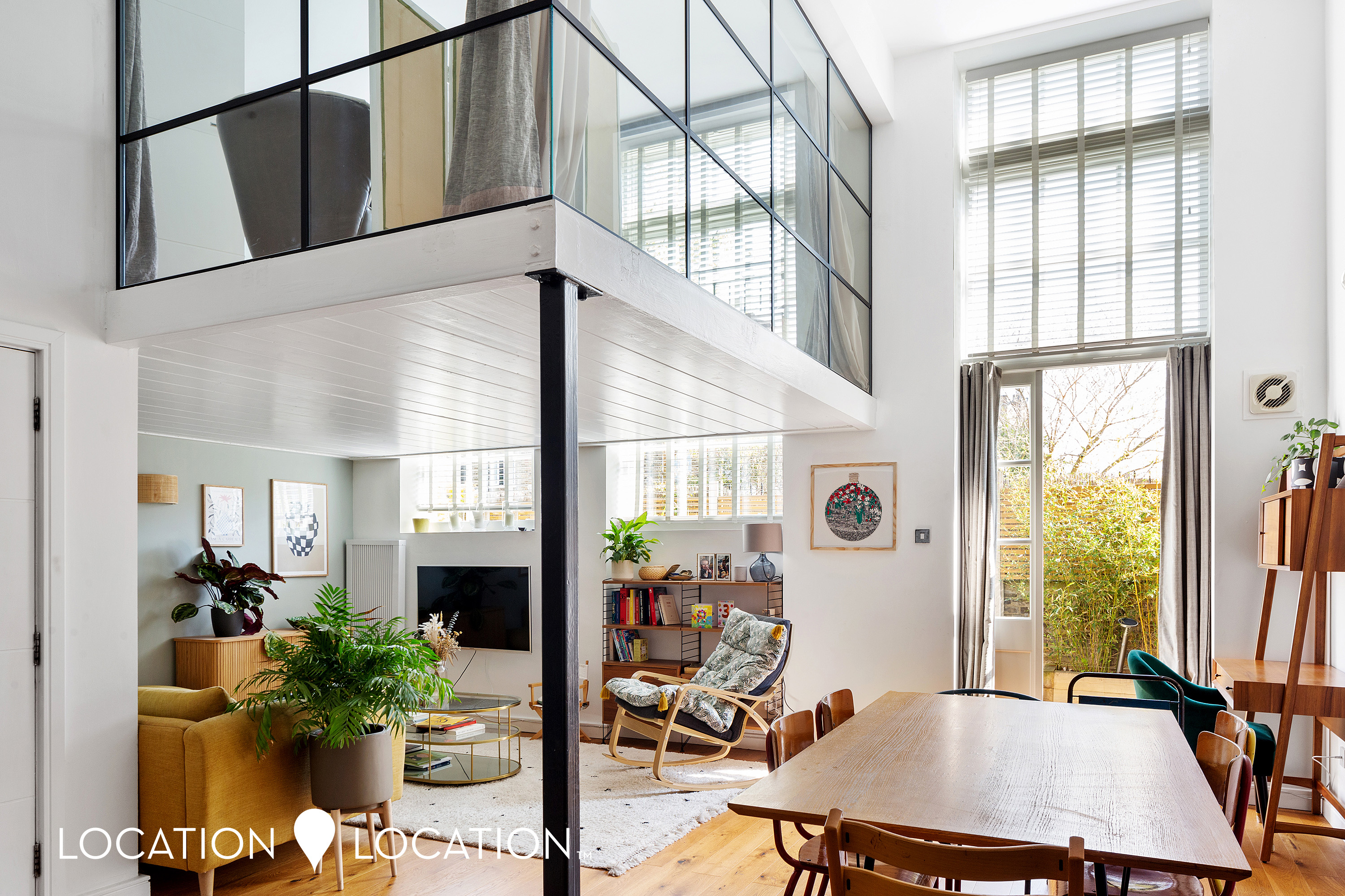
Property Information Report

Scholars Place
London, N16
Last Sold - Mar, 2024
Key Facts
About Us

About Us
Since 2006 we’ve committed ourselves to helping people move happy. We do so with a promise to support the local community too. We feel estate agency can and should be done differently; in a professional and yet personal way. Everything we do is designed around you and our team of property experts all have one thing in common – they care.
Find out more at locationlocation.com
Title Plan
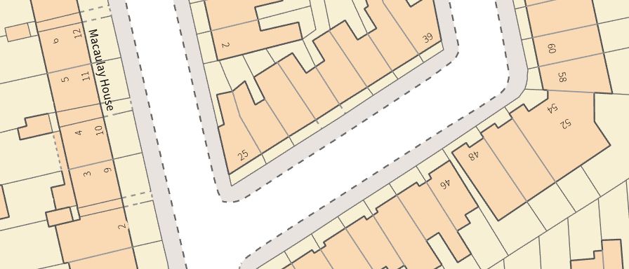 Contains OS data © Crown copyright 2025
Title Information
Details provided by the Land Registry
- Title Number
- EGL425664
- Plot Size
- 0.27 acres (1102 sq metres)
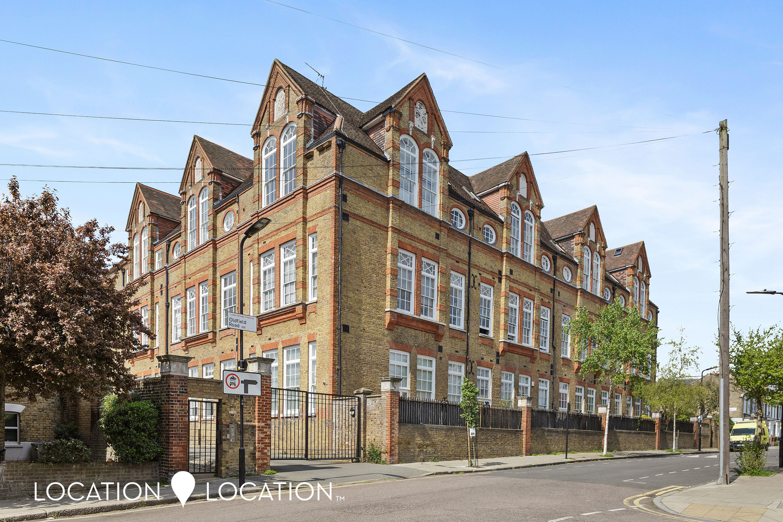
Street View
House Prices in Hackney
Last 12 months
-
Average Price Change
£14,785
Decreased by 2%
-
Flats/Maisonettes Price Change
£14,840
Decreased by 3%
Average House Prices
Last 12 months for all property types.
Since Last Sale - 7th March 2024
-
Average Price Change
£5,689
Decreased by 1%
-
Flats/Maisonettes Price Change
£11,284
Decreased by 2%
Average House Prices
Since 2020 for all property types
EPC
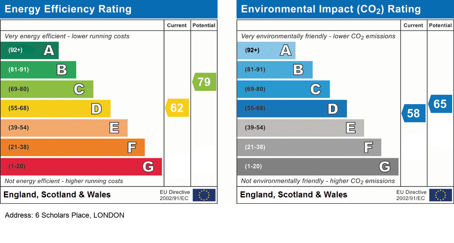
EPC Information
Details taken from the EPC register
- Date
- 2017-06-15
- Valid Until
- 2027-06-14
- Energy Efficiency - Current
- 62
- Energy Efficiency - Potential
- 79
- Environmental Impact - Current
- 58
- Environmental Impact - Potential
- 65
Recently Sold Properties in the Area
| Address | Property Type | Distance | Price | Completed |
|---|---|---|---|---|
|
30 Scholars Place London, N16 0RF |
Flats/Maisonettes | away | £740,000 | 7 months ago |
|
49 Defoe Road London, N16 0EH |
Terraced | 49 metres away | £482,000 | 5 months ago |
|
22 Ayrsome Road London, N16 0RD |
Terraced | 65 metres away | £1,101,150 | 9 months ago |
|
12 Woodlea Road London, N16 0TP |
Terraced | 0.10 km away | £1,310,000 | 10 months ago |
|
132 Nevill Road London, N16 0SX |
Terraced | 0.11 km away | £1,725,000 | 4 months ago |
|
118 Nevill Road London, N16 0SX |
Terraced | 0.13 km away | £1,020,000 | 7 months ago |
|
110 Nevill Road London, N16 0SX |
Terraced | 0.14 km away | £1,326,000 | 10 months ago |
|
12 Painsthorpe Road London, N16 0RB |
Terraced | 0.15 km away | £1,075,000 | 10 months ago |
|
32 Chesholm Road London, N16 0DR |
Terraced | 0.17 km away | £1,375,000 | 10 months ago |
|
Flat 9, St. Mary's Court, 3 Defoe Road London, N16 0EP |
Flats/Maisonettes | 0.17 km away | £430,000 | 3 months ago |
Schools
| Name | Type | Postcode | Distance | Rating |
|---|---|---|---|---|
| St Mary's Church of England Primary School, Stoke Newington | Primary | N16 0JT | 0.25 km | Good |
| William Patten Primary School | Nursery, Primary | N16 0NX | 0.37 km | Outstanding |
| Betty Layward Primary School | Nursery, Primary | N16 9EX | 0.43 km | Good |
| Stoke Newington School and Sixth Form | Secondary, Post 16 | N16 9EX | 0.43 km | Good |
| Grazebrook Primary School | Nursery, Primary | N16 0QP | 0.50 km | Outstanding |
Transport
Bus Stops & Stations
Details provided by Department for Transport
| Name | Distance |
|---|---|
| Stoke Newington Town Hall, STOKE NEWINGTON CHURCH STREET | 0.24 km |
| Abney Park, STOKE NEWINGTON CHURCH STREET | 0.25 km |
| Abney Park | 0.25 km |
| Stoke Newington Town Hall, ALBION ROAD | 0.26 km |
| Barbauld Road | 0.28 km |
Train Stations
Details provided by Department for Transport
| Name | Distance |
|---|---|
| Stoke Newington Station | 0.73 km |
| Stoke Newington Rail Station | 0.73 km |
| Rectory Road Station | 0.80 km |
| Rectory Road Rail Station | 0.82 km |
| Dalston Kingsland Station | 1.37 km |
Nearest Motorway
Details provided by Department for Transport
| Name | Distance |
|---|---|
| M11 | 8.67 km |
Coverage
- Average Broadband Speed:
-
16mb Basic
-
1000mb Ultrafast
-
1000mb Overall
- Mobile Coverage:
-
EEOkay
-
O2Good
-
ThreePoor
-
VodafoneOkay

Location Location, 18 Stoke Newington Church Street, London, N16 0LU
Selling with Location Location
Generate a full report on your own property including an instant estimated valuation.
Important Notice - This report is intended for general informational purposes only and should act only as a guide. The report is produced automatically on behalf of Location Location - Location Location Hackney by Street Insights, a product of Street Systems Ltd. Street Systems maintains and aggregates data from multiple public data sources and whilst every effort is made to keep information up to date and accurate, we make no representations or warranties of any kind about the accuracy, reliability or completeness of the information contained within this report for any purpose. Any reliance you place on the data contained within this report is strictly at your own risk. In no event will Location Location - Location Location Hackney or Street Systems Ltd be liable for any loss or damage including without limitation, indirect or consequential loss or damage, or any loss or damage whatsoever arising from loss of data or profits arising out of, or in connection with, the use of this report.
This report contains public sector information licensed under the Open Government License v3.0
Transaction data and HPI data is produced by HM Land Registry. Crown copyright and database rights 2025