Buyer Information Report

Walford Road
London, N16
Last Sold - Apr, 2013
Description
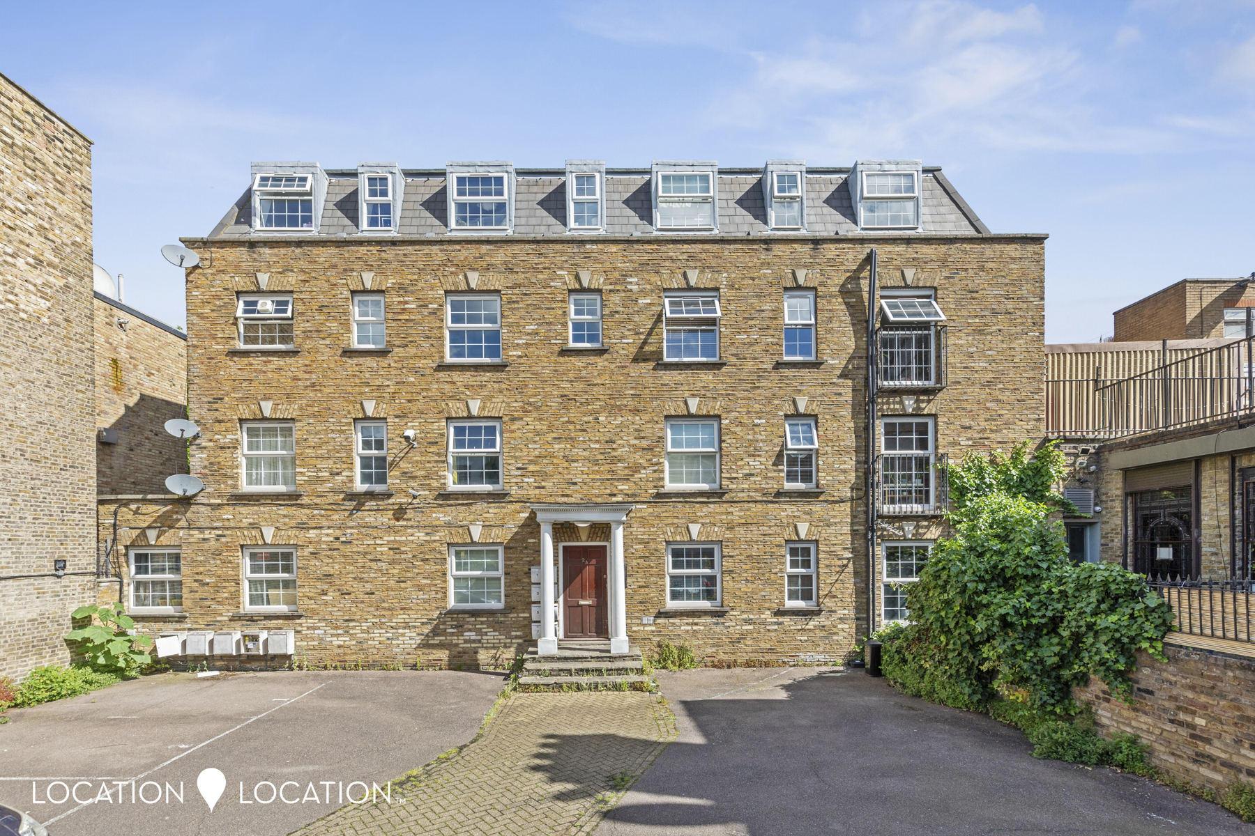
At over 600 SQFT, this spacious purpose built apartment is perfectly positioned in a quiet, gated, residential development comprised of seven flats. Located moments from vibrant Dalston and eclectic Stokey High Street this home offers space to grow into and is also close to speedy links across the City.
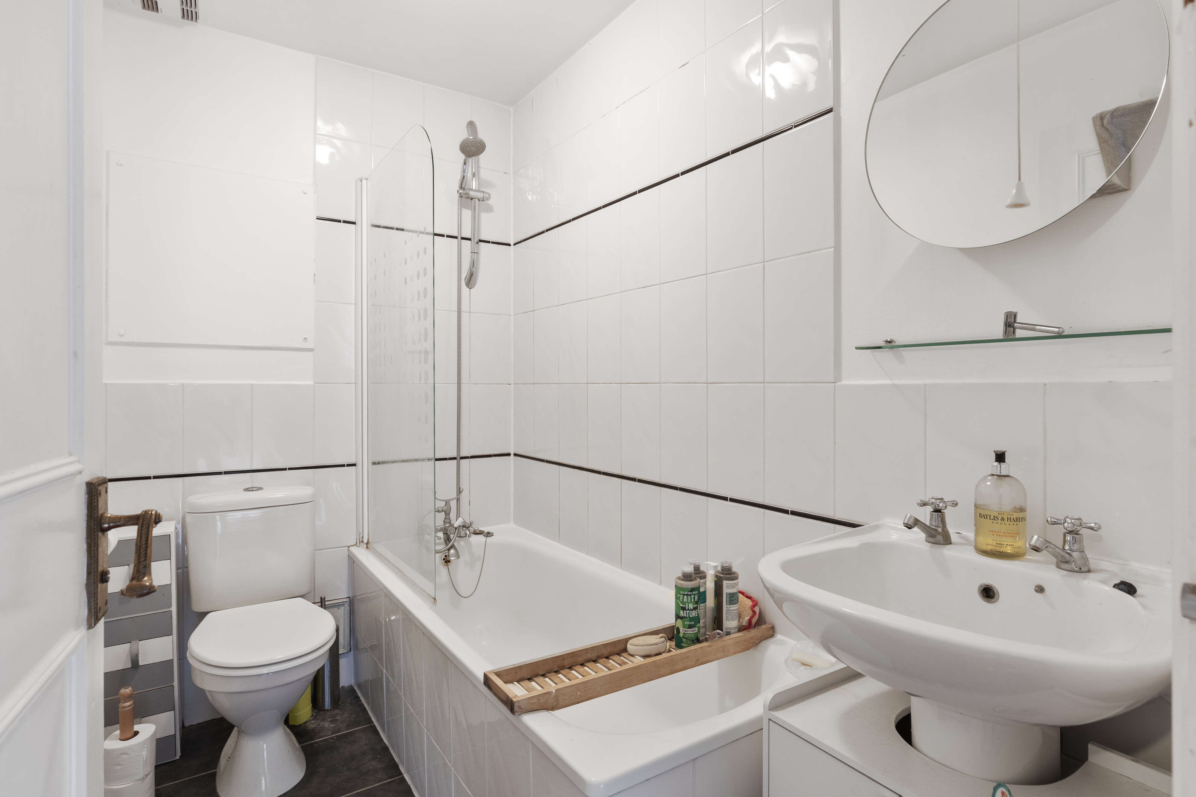
Situated on the second floor and flooded with natural light, the apartment comprises; an ample double bedroom with fitted wardrobes, a second well-sized bedroom and a spacious bathroom, with bath and shower. There is a large reception room, too, which seamlessly interconnects to the fully fitted eat in kitchen with plenty of counter space- an excellent space to dine and entertain.
Additional benefits include allocated parking space (gated).
Chilcott Court is conveniently located for quick links around the City, and for short walks to Dalston and Church Street. Stokey High Street is just around the corner, and both Butterfield Green, Clissold Park and Hackney Downs are close by, too, making popular picnic spots in the warmer months.
Key Facts
About Us

About Us
Since 2006 we’ve committed ourselves to helping people move happy. We do so with a promise to support the local community too. We feel estate agency can and should be done differently; in a professional and yet personal way. Everything we do is designed around you and our team of property experts all have one thing in common – they care.
Find out more at locationlocation.com
Title Plan
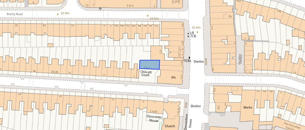 Contains OS data © Crown copyright 2025
Title Information
Details provided by the Land Registry
- Title Number
- EGL546355
- Plot Size
- 0.04 acres (142 sq metres)
Generate a full report on your own property including an instant estimated valuation.
Street View
House Prices in Hackney
Last 12 months
-
Average Price Change
£13,955
Decreased by 2%
-
Flats/Maisonettes Price Change
£14,912
Decreased by 3%
Average House Prices
Last 12 months for all property types.
Since - May 2020
-
Average Price Change
£6,632
Increased by 1%
-
Flats/Maisonettes Price Change
£1,689
Decreased by 0%
Average House Prices
Since 2020 for all property types
EPC
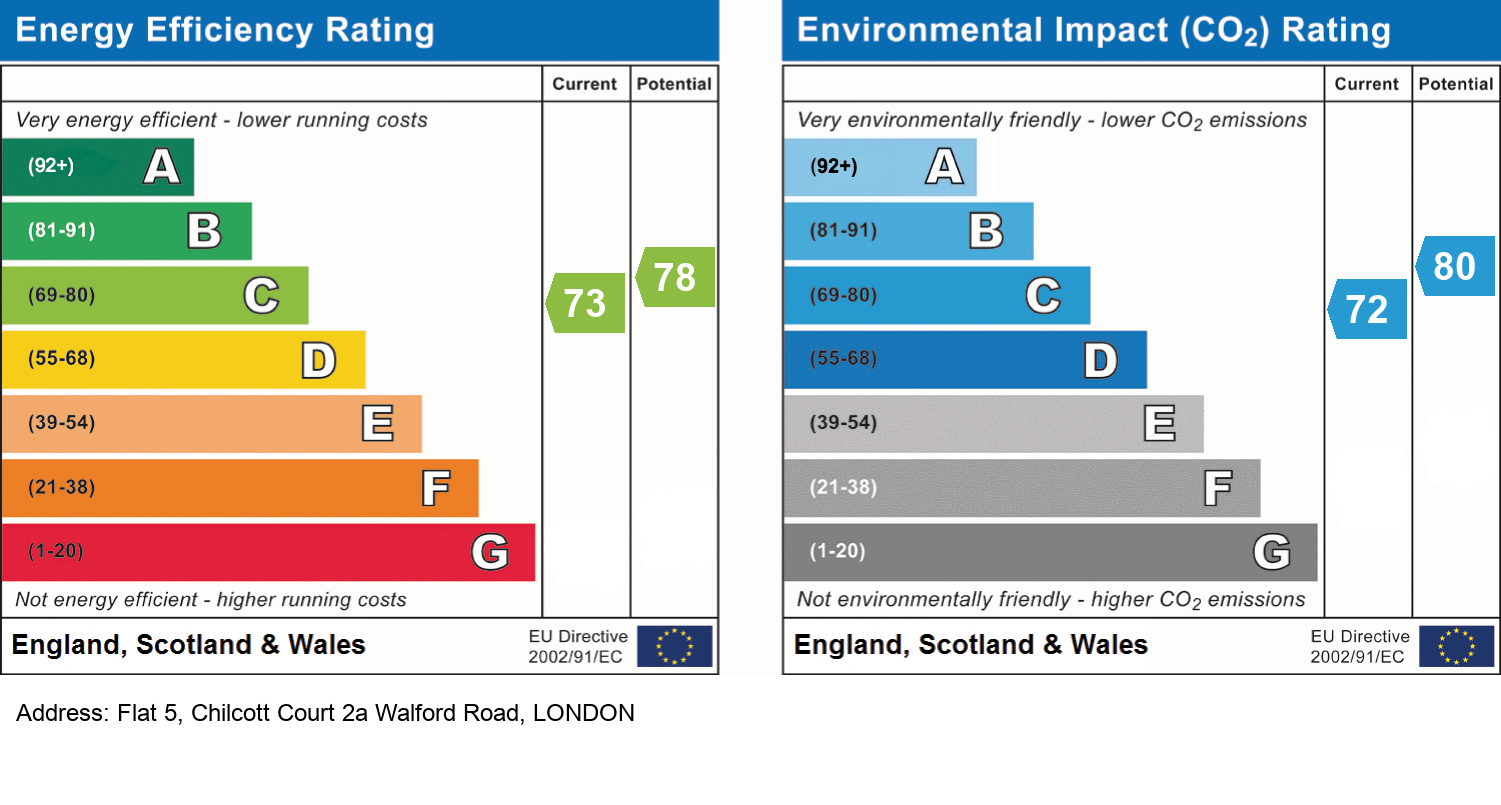
EPC Information
Details taken from the EPC register
- Date
- 2023-03-31
- Valid Until
- 2033-03-30
- Energy Efficiency - Current
- 73
- Energy Efficiency - Potential
- 78
- Environmental Impact - Current
- 72
- Environmental Impact - Potential
- 80
Recently Sold Properties in the Area
| Address | Property Type | Distance | Price | Completed |
|---|---|---|---|---|
|
Flat 5, 127 Stoke Newington Road London, N16 8BT |
Flats/Maisonettes | 11 metres away | £497,000 | 11 months ago |
|
Flat 3, 1 Beatty Road London, N16 8EA |
Flats/Maisonettes | 55 metres away | £382,500 | 9 months ago |
|
5 Beatty Road London, N16 8EA |
Flats/Maisonettes | 58 metres away | £570,000 | 4 months ago |
|
Flat D, 24-26, Walford Road London, N16 8ED |
Flats/Maisonettes | 73 metres away | £405,000 | 10 months ago |
|
32b, Walford Road London, N16 8ED |
Flats/Maisonettes | 94 metres away | £330,000 | 4 months ago |
|
Second Floor Flat, 2a, Foulden Road London, N16 7UR |
Flats/Maisonettes | 0.10 km away | £945,000 | 8 months ago |
|
Flat 7, Button Court, 177 Victorian Grove London, N16 8GL |
Flats/Maisonettes | 0.11 km away | £682,500 | 3 months ago |
|
Flat 2, 9 Beatty Road London, N16 8EA |
Flats/Maisonettes | 0.12 km away | £570,000 | 10 months ago |
|
9 Beatty Road London, N16 8EA |
Detached | 0.12 km away | £1,850,000 | 8 months ago |
|
343b, 343b-343d, Amhurst Road London, N16 7UX |
Flats/Maisonettes | 0.13 km away | £257,500 | 7 months ago |
Schools
| Name | Type | Postcode | Distance | Rating |
|---|---|---|---|---|
| The Garden School | Special | N16 8BZ | 0.31 km | Outstanding |
| Princess May Primary School | Nursery, Primary | N16 8DF | 0.40 km | Good |
| Shacklewell Primary School | Nursery, Primary | E8 2EA | 0.44 km | Outstanding |
| Halley House School | Nursery, Primary | E8 2DJ | 0.45 km | Good |
| St Matthias Church of England Primary School | Nursery, Primary | N16 8DD | 0.49 km | Good |
Transport
Bus Stops & Stations
Details provided by Department for Transport
| Name | Distance |
|---|---|
| Amhurst Road | 34 metres |
| Stoke Newington Rd /Amhurst Rd, STOKE NEWINGTON ROAD | 49 metres |
| Stoke Newington Police Station | 0.21 km |
| Princess May Road | 0.36 km |
| Manse Road | 0.39 km |
Train Stations
Details provided by Department for Transport
| Name | Distance |
|---|---|
| Rectory Road Station | 0.54 km |
| Rectory Road Rail Station | 0.55 km |
| Dalston Kingsland Station | 0.87 km |
| Dalston Kingsland Rail Station | 0.88 km |
| Stoke Newington Rail Station | 1.04 km |
Nearest Motorway
Details provided by Department for Transport
| Name | Distance |
|---|---|
| M11 | 8.57 km |
Coverage
- Average Broadband Speed:
-
5mb Basic
-
31mb Superfast
-
1000mb Ultrafast
-
1000mb Overall
- Mobile Coverage:
-
EEOkay
-
O2Good
-
ThreeOkay
-
VodafoneOkay

Location Location, 18 Stoke Newington Church Street, London, N16 0LU
Selling with Location Location
Important Notice - This report is intended for general informational purposes only and should act only as a guide. The report is produced automatically on behalf of Location Location - Location Location Hackney by Street Insights, a product of Street Systems Ltd. Street Systems maintains and aggregates data from multiple public data sources and whilst every effort is made to keep information up to date and accurate, we make no representations or warranties of any kind about the accuracy, reliability or completeness of the information contained within this report for any purpose. Any reliance you place on the data contained within this report is strictly at your own risk. In no event will Location Location - Location Location Hackney or Street Systems Ltd be liable for any loss or damage including without limitation, indirect or consequential loss or damage, or any loss or damage whatsoever arising from loss of data or profits arising out of, or in connection with, the use of this report.
This report contains public sector information licensed under the Open Government License v3.0
Transaction data and HPI data is produced by HM Land Registry. Crown copyright and database rights 2025